
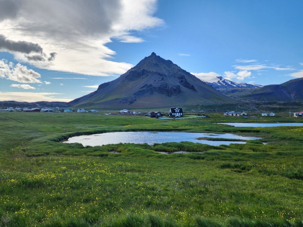
We continued driving eastward along the southern coast of the Snæfellsnes Peninsula. Most of the sights for the afternoon/evening were clustered around the quiet fishing villages of Arnarstapi and Hellnar.
- Lóndrangar view point
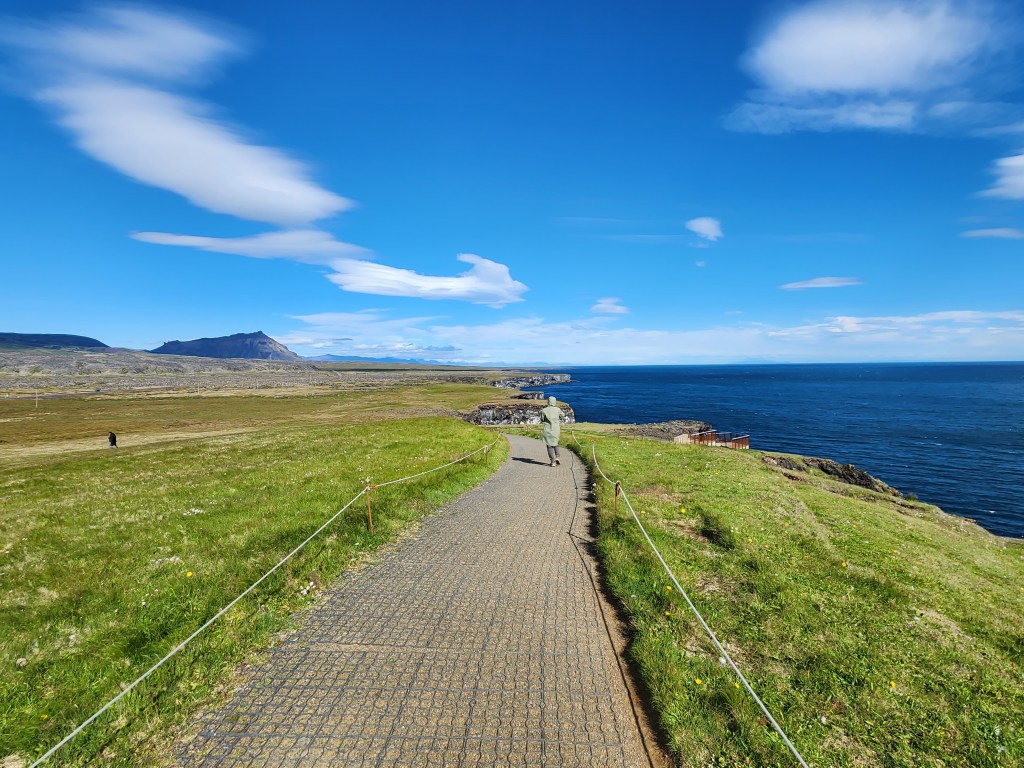
- Hellnar view point
- Arnarstapi/Bárður Snæfellsás saga statue
- Gatklettur stone formation
- Pumpa
- Bjarnarfoss (waterfalls)
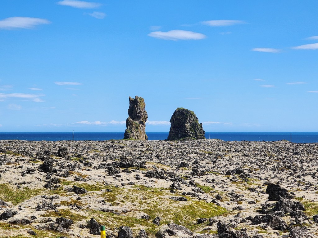
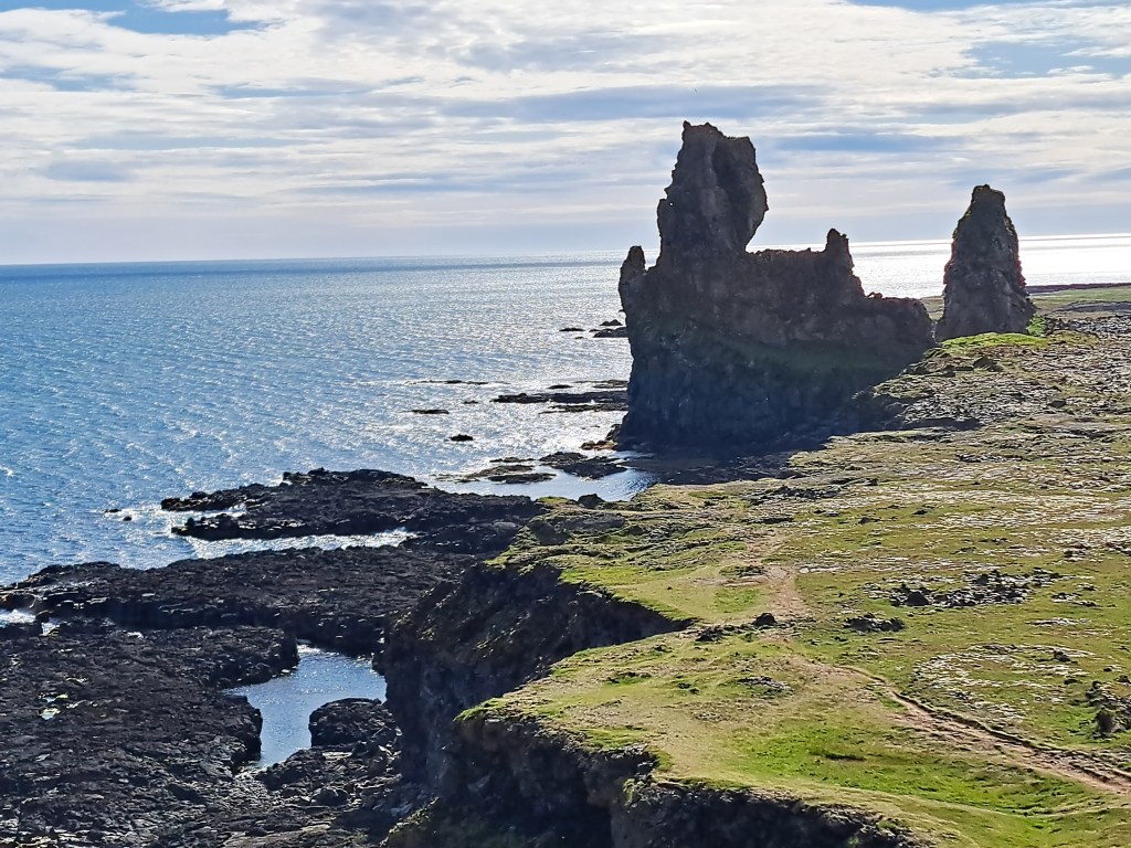
- Lóndrangar
Once a volcanic crater, all that remains after aeons of ocean battering are two great pillars upon a cliff, one 75 metres (246 ft) high and the other 61 metres (200 ft). Their dramatic position has earned the two formations the nickname The Rocky Castle.
The Lóndrangar are the worn remnants from a bigger crater which has mostly eroded away.

It was only a short drive further along the coast to reach the first of two small towns nearby.
2. Hellnar

An ancient fishing village mentioned in written form since the 1560s, it was the birthplace of Guðríður Þorbjarnardóttir, the wife of Þorfinnur Karlsefni, a legendary Icelandic explorer.
The couple settled in Vinland (Newfoundland) in 1004 and Guðríður gave birth to the first European child to be born in North America. We saw the remains of his settlement when we visited L’Anse aux Meadows in Newfoundland a few years ago.

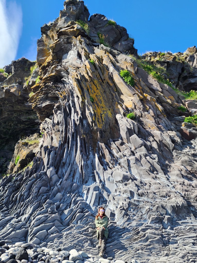
A short walk down from the main road is an unusual rock formation called Baðstofa. The rock has been bent and curved by tectonic activity but hadn’t shattered. It was a unique sight.


By now it was early evening but the sun was still high in the sky. We headed back to the car and drove towards an even more photogenic town just a few minutes away: Arnarstapi.
3. Arnarstapi/Bárður Snæfellsás saga statue
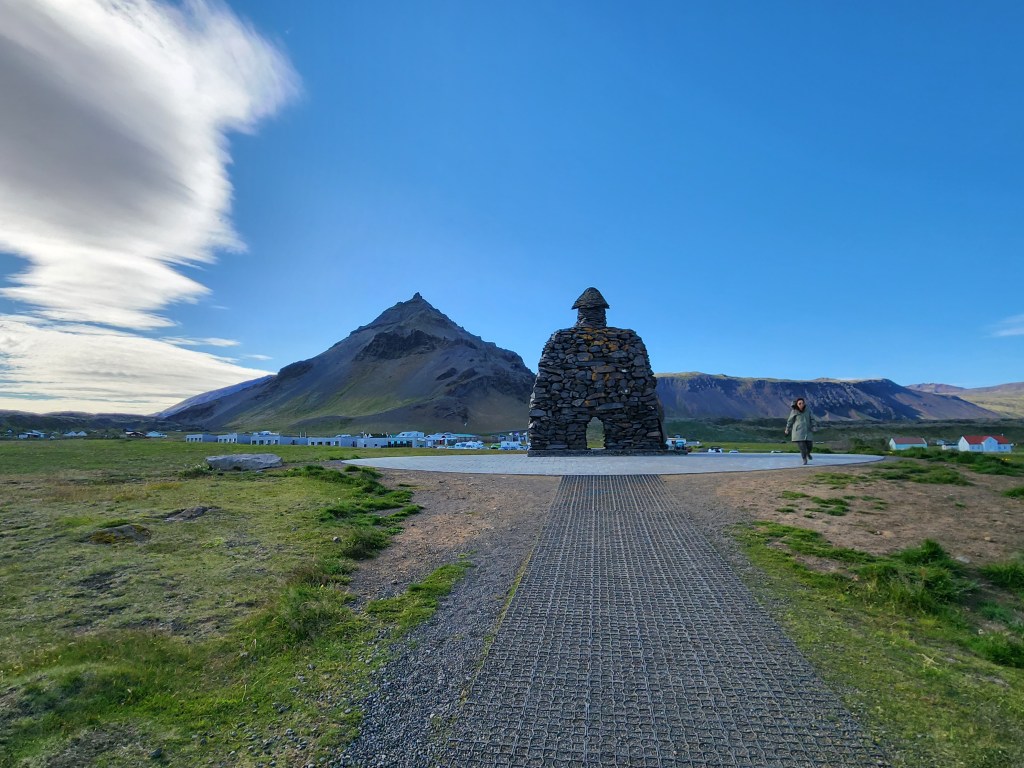
A story originating in the early 14th century, Bárður was half a troll, and half a man. His father was half a titan, but his mother was human. Bárður came to Iceland in the 9th century and gave the Snjófellsnes peninsula its name.
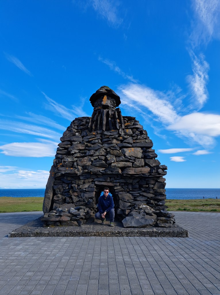
After many adventures, Barðr gave away his land and vanished into the Snæfellsjökull ice cap. He became known as Bárðr Snæfellsáss, meaning the “guardian spirit” of Snæfell. The statue was made with local stone and completed in 1978.
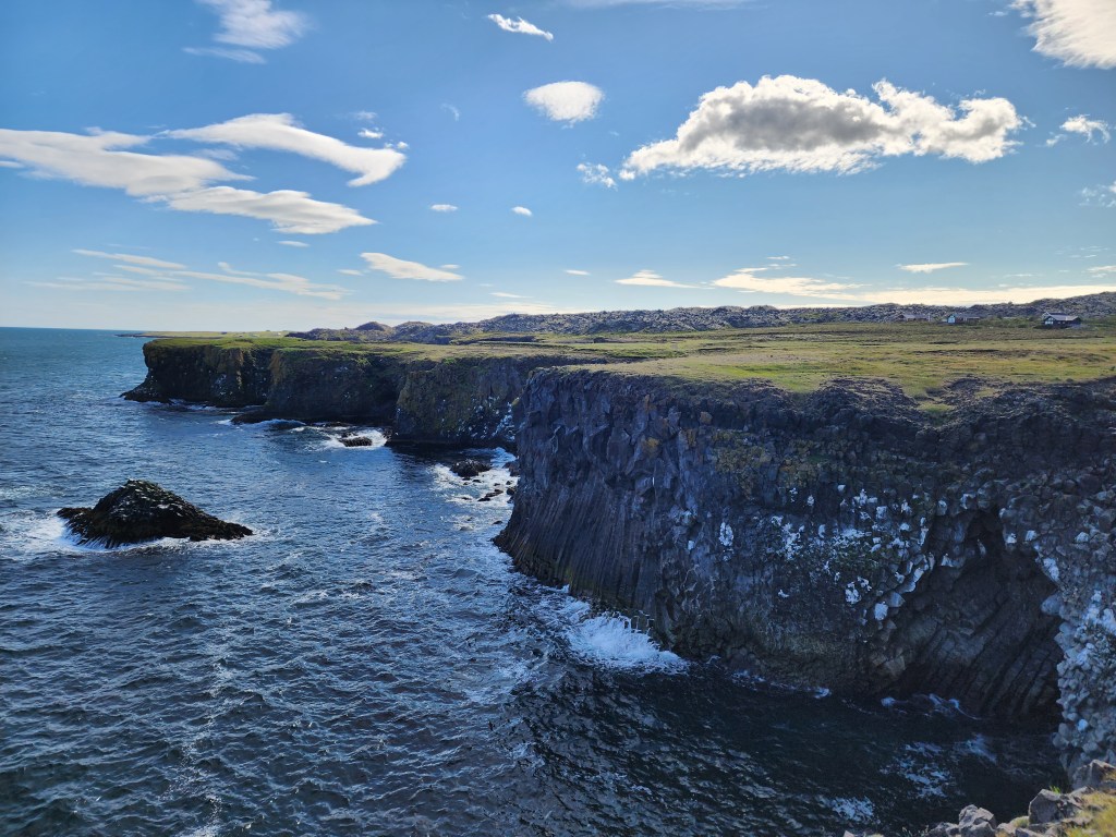
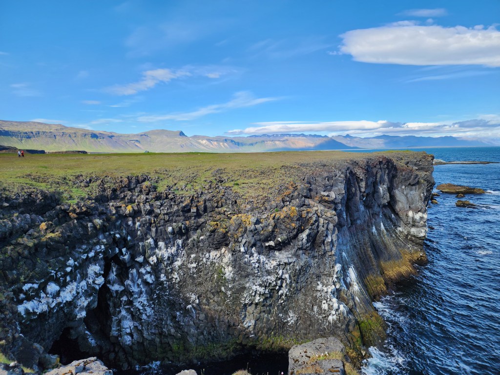
After checking out the statue we continued past it to views of the rocky cliffs.
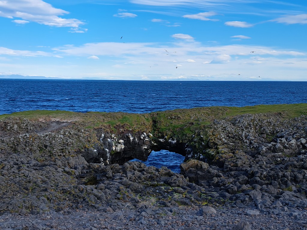
4. Gatklettur stone formation

From the first coastal viewpoint we walked eastward towards more formations nearby. The first was an unusual circular arch called Gatklettur. Further along were a number of other curious formations.


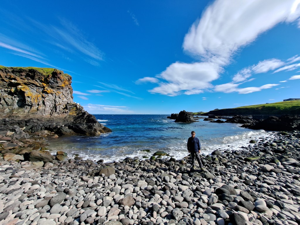
6. Pumpa

Our last stop in the area was at Pumpa, a pretty spot close to Arnarstapi harbour. From there we walked through the town back to our car.

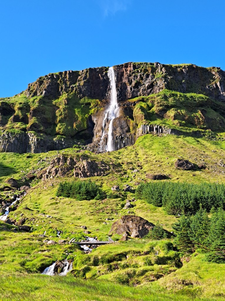
6. Bjarnarfoss (waterfalls)
By now it was almost 8 p.m. and we still had to get back to the hotel to make dinner, but there was time for one more stop along the way. Bjarnarfoss is a two-tiered waterfall that falls 80m (262 ft).
When we arrived there was no one else around so we had it to ourselves. We climbed up the path for about 10 minute to reach the viewpoint.


We were able to get back to our hotel just before 9 p.m. It meant a late pasta dinner made in the kitchen but the sights on this day made it all worthwhile.
