

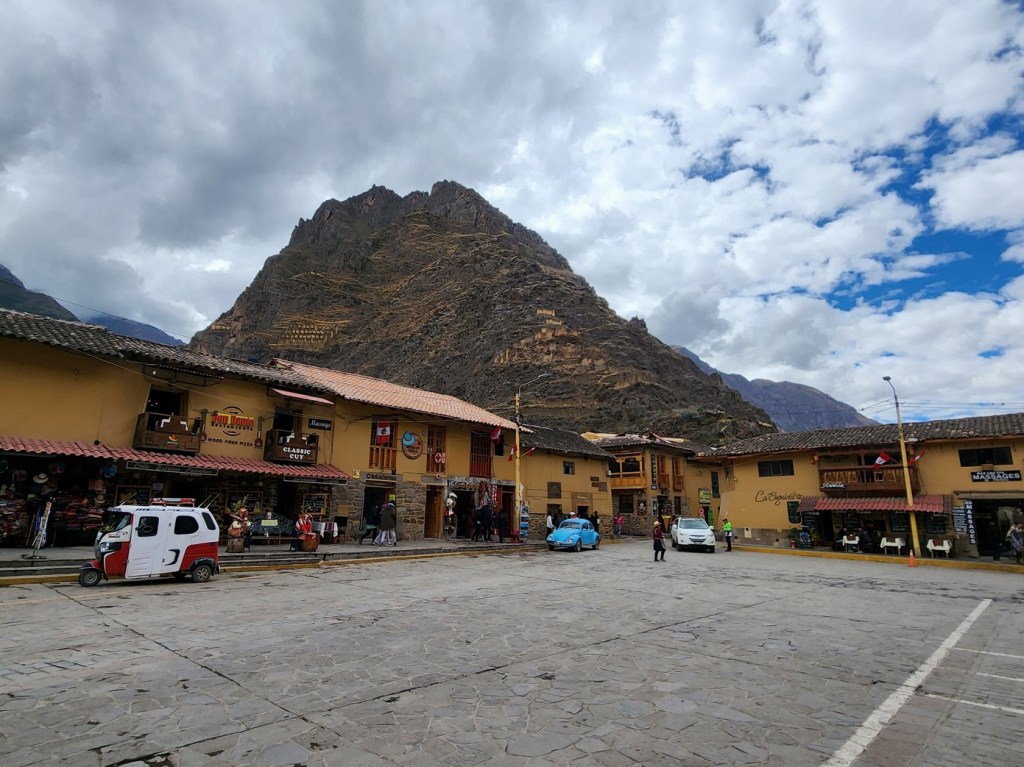
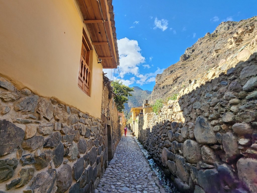
We spent our first full day in Ollantaytambo exploring the ruins surrounding the town. Walking from our hotel in the west end of town over to the ruins in the east would normally take less than 10 minutes, though repair work on the main road meant a brief detour to get there. Nevertheless, it was only about 15 minutes to get to the main ruins of the town.
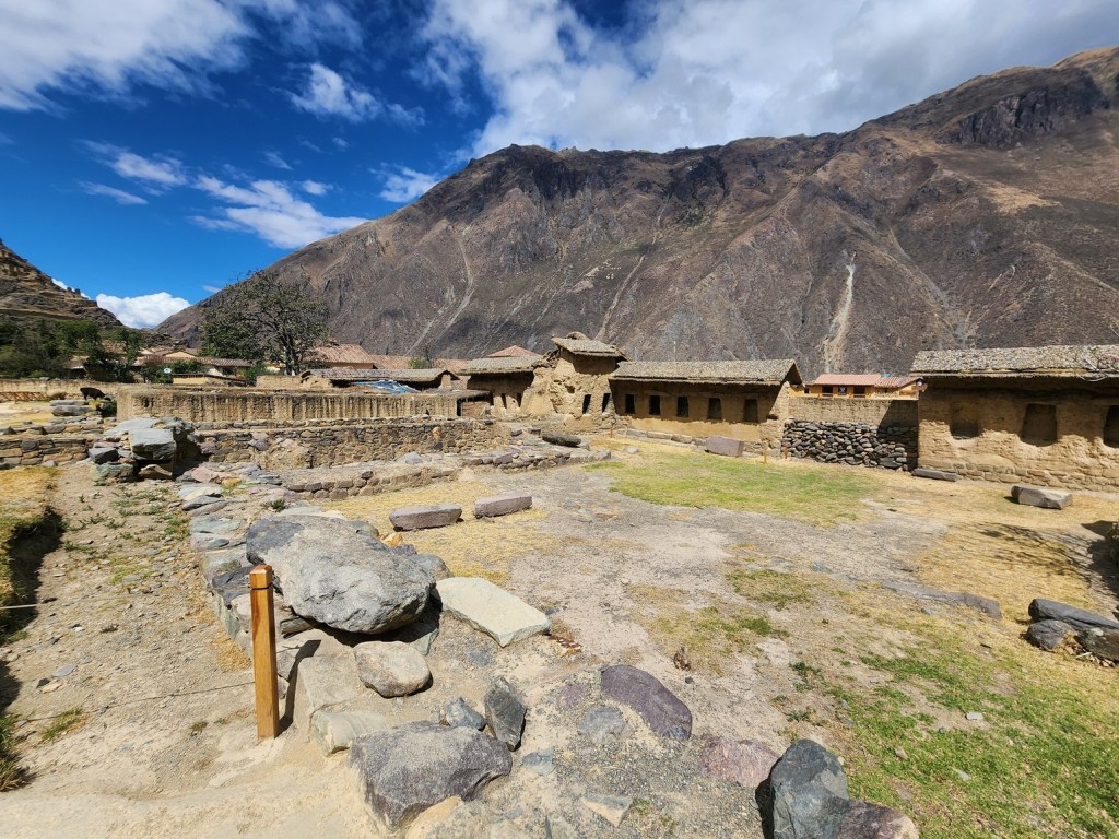
Ollantaytambo still has most of its original streets, canals, and buildings preserved. The grid layout of the town reflects advanced urban planning for the time.


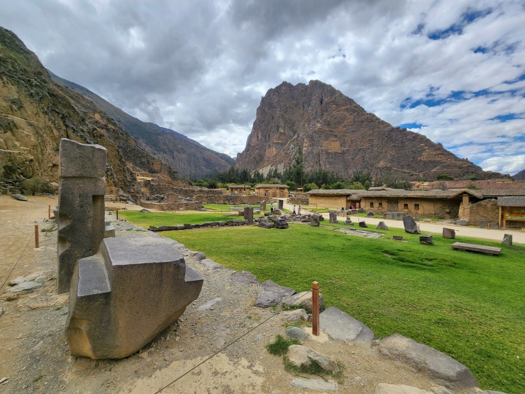
Ollantaytambo has one of the most significant and well-preserved Inca archaeological sites in Peru. Located in the Sacred Valley of the Incas, about 72 kilometers (45 miles) northwest of Cusco, it served as a religious, military, and agricultural hub during the height of the Inca Empire.
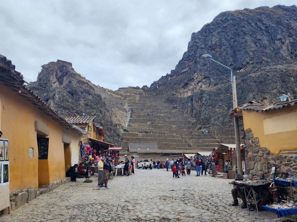
We arrived in the mid morning, with large groups of people at the bottom waiting to get in. We decided to go up first in order to avoid the crowds at the bottom. It turned out to be a good choice as we made our way up.

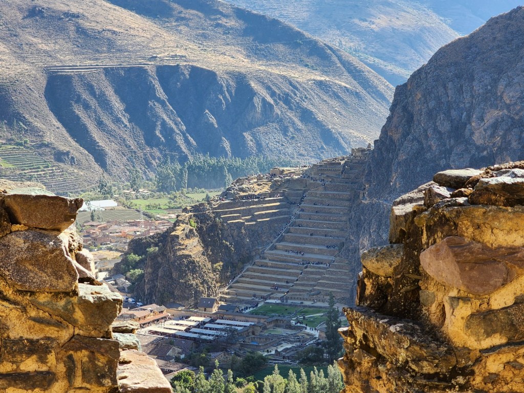
The Inca constructed a series of terraces along the mountainside, allowing for efficient farming in the rugged terrain. These terraces provided food for the local population and helped prevent erosion.

Ollantaytambo was originally inhabited by the local ethnic group known as the Tampu before being conquered by the Incas. Under the reign of Pachacuti Inca Yupanqui (1438–1471), the site was expanded and transformed into a royal estate. Pachacuti built terraces, temples, and sophisticated water systems to support agricultural and ceremonial activities.


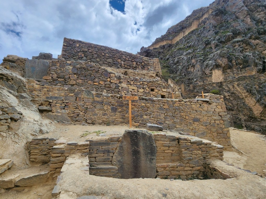
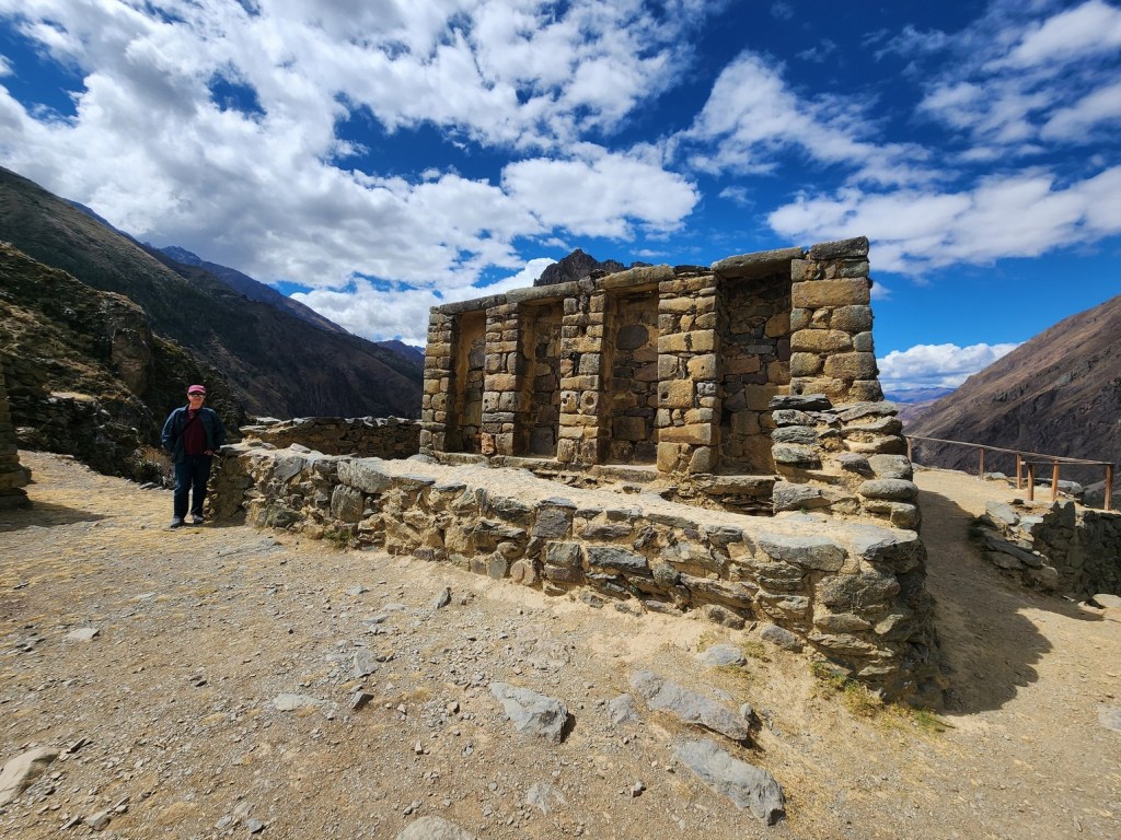
The Temple of the Sun consists of six massive pink granite monoliths, each weighing over 50 tons. These stones were quarried from a site across the Urubamba River, raising questions about how they were transported.
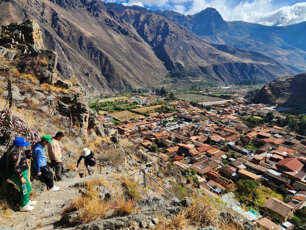
As we went higher, there were fewer tourists. The crowds we saw at the entrance had dissolved to a trickle. Part of it is due to the climbing required to get to the higher parts of the site, and part of it is the spread of nature of it, allowing for tourists to disperse to different sections. Whatever the reason, we appreciated the lack of density!

During the Spanish conquest in the 1530s, Manco Inca Yupanqui, a leader of the Inca resistance, fortified Ollantaytambo and used it as a stronghold against the Spanish forces. In 1537, Manco Inca won a rare victory against the conquistadors by using the site’s elevated terraces and strategic location to his advantage. However, he eventually retreated to Vilcabamba, allowing the Spanish to take control.

After checking out the lower section, we followed the arrows the led to a doorway that took us to the narrow trail winding up the mountain. There were just a few other people by this point, with the toughest section ahead.


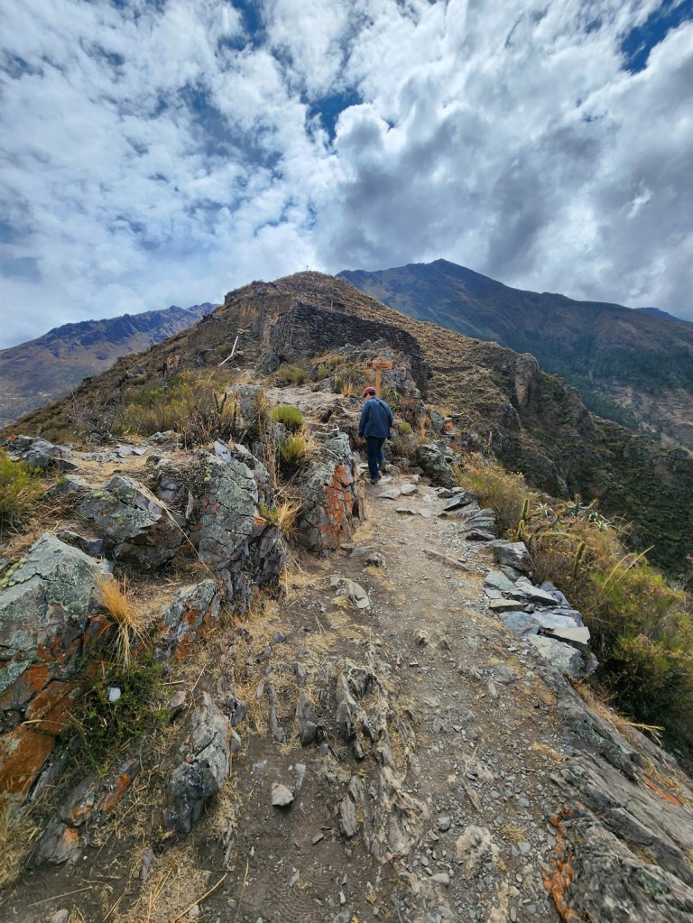
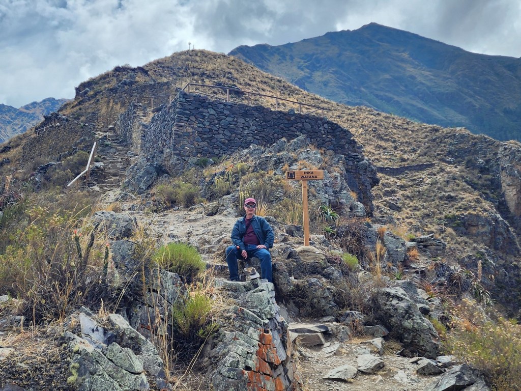
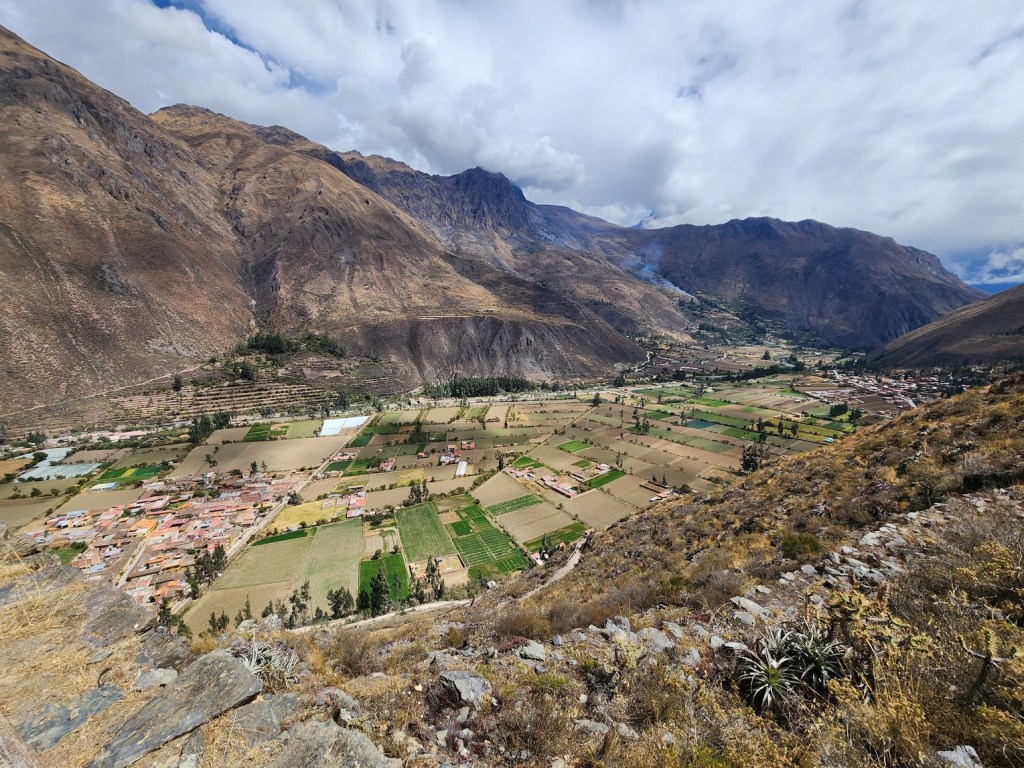
We finally made it to the Inka Watana at the top. Here we had a full view of the town as well as views of both sides of the valley. It was truly a breathtaking spot.
The Inka Watana refers to the Intihuatana stone, a prominent ceremonial stone believed to have been used by the Incas for astronomical observations and rituals, located within the larger Ollantaytambo archaeological site

From here there was an option to continue winding around a long trail before returning to the bottom, or returning the way we had come. Since we wanted to see the ruins on the other side in the afternoon, we chose the latter, which was the quicker route back.


After we finished doing the main ruins, we took a break at a local cafe and had something to keep us going through the afternoon. After a couple of hours including a brief stop back at the hotel, we headed back out for the second part of our day.

After the late morning break, we headed to the ruins of Pinkuylluna and El Tunupa. They were only a 10 minute walk from our hotel as it was also on the west side of town. Both of these ruins are smaller and less popular than the main ones, but were free and worth the climb.


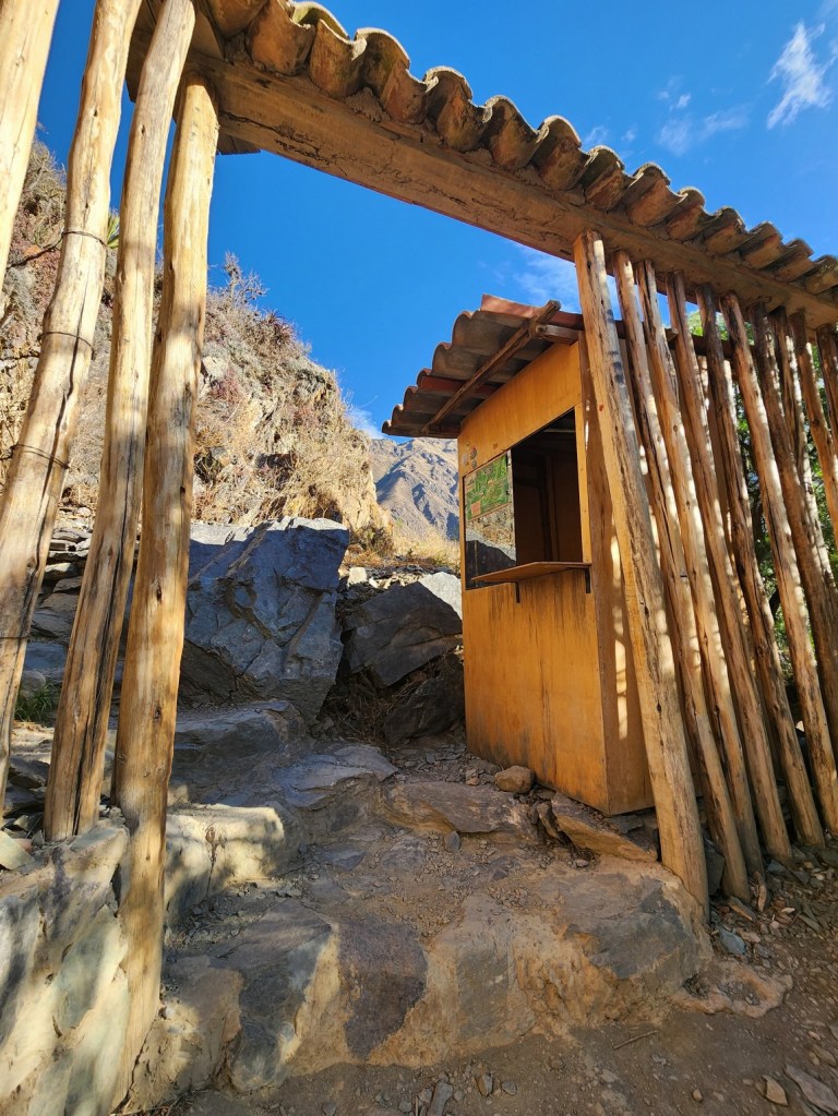
The entrance is located on Lares Calle street, on the west side of town. It’s a short walk from the main road and easy to find.

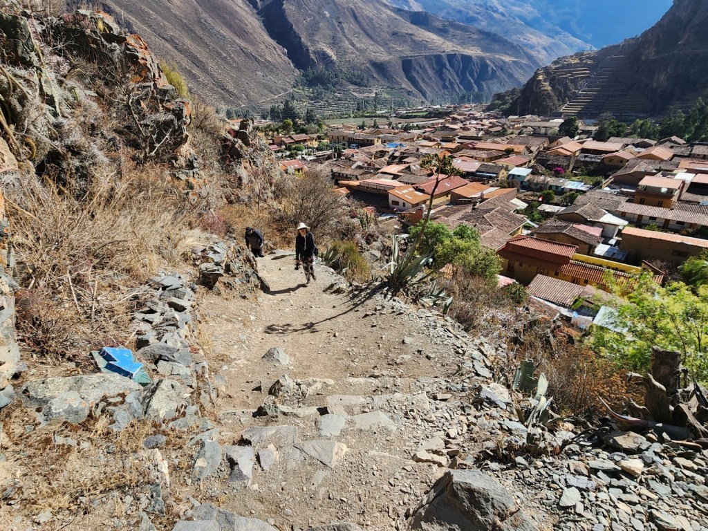


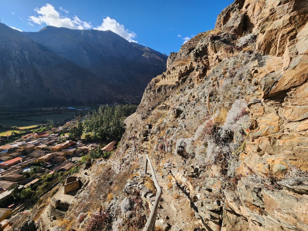
It was windy as we scrambled up the rocky trail. It wasn’t easy, but if you go carefully it’s not too challenging. It took 30 or 40 minutes to reach the storehouses from the entrance, and we only saw a few other people on the trail.
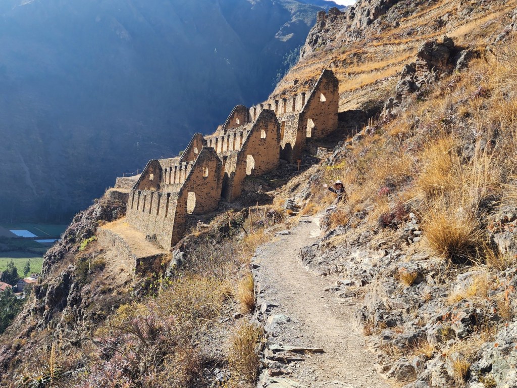


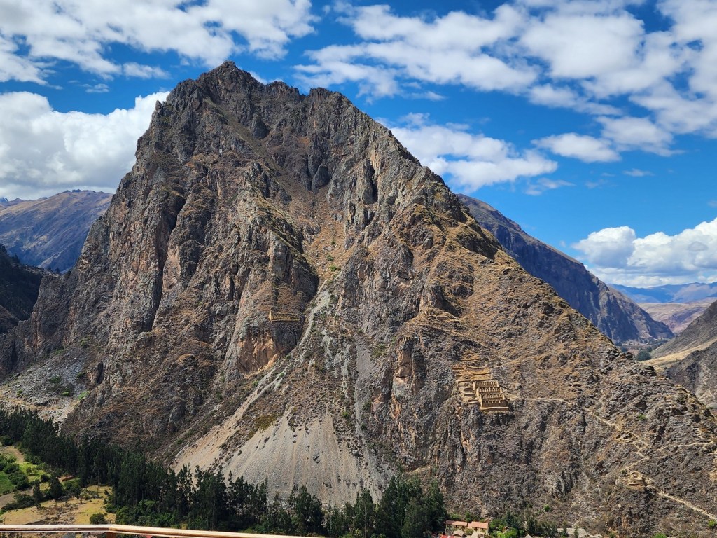
The name “Pinkuylluna” derives from the Pinkuyllu, a type of flute found throughout the Andes. It’s unknown if literal Pinkuyllu were played at the site, as the name may also be a reference to the prominent local mountain winds. We experienced those winds through the climb and especially around the storehouses.

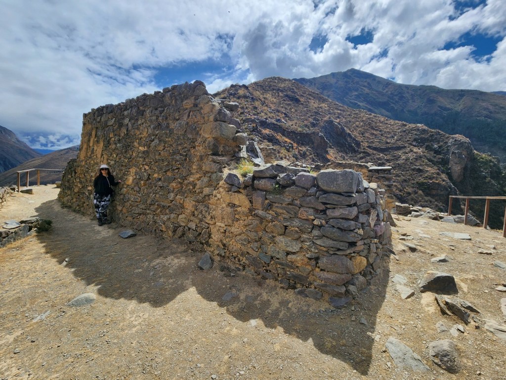
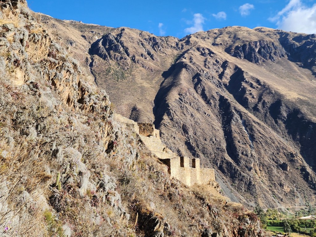
The site consists mainly of storehouses used to store the grain and other crops produced in the surrounding agricultural terraces. The storehouses were likely built in the 15th century by emperor Pachacuti. The storehouses were built at high altitude to both preserve the food (more wind and cooler temperatures) and to protect their food stores in the case of attack.
After doing Pinkuylluna, we walked back the way we came, but instead of heading down we continued on a different trail and headed towards the smaller sets of ruins at El Tunupa.


These ruins were small, and are not a must-see, but since we were close by we figured “Why not?” and checked them out. It only took a few minutes to see everything there. After that, we made our way back down.


After a tiring day of hiking, we headed to the main part of town to have dinner. We chose a place for dinner that had some healthier options. I went for the simple grilled chicken breast with a trio of sauces along with salad and local potatoes. I was happy as the chicken was tender and the potatoes were amazing! Kim didn’t do as well as she had a mushroom and vegetable stir-fry with a very salty sauce. She had a bit of a stomach problem the next day.

We enjoyed the local sights in Ollantaytambo. The town was compact, picturesque and had some great ruins in walking distance. Now that we had done the town, we were ready for the big trip the next day: a day trip by train to Machu Picchu. That will be the focus out the next post.
