

After driving through the County Waterford and the Copper Coast, we continued westward towards our next accommodation near Kinsale. On this day, we did the Ardmore Round Tower, Capel Way Coastal Trail and Ballycotton Cliff Walk.
Ardmore Tower
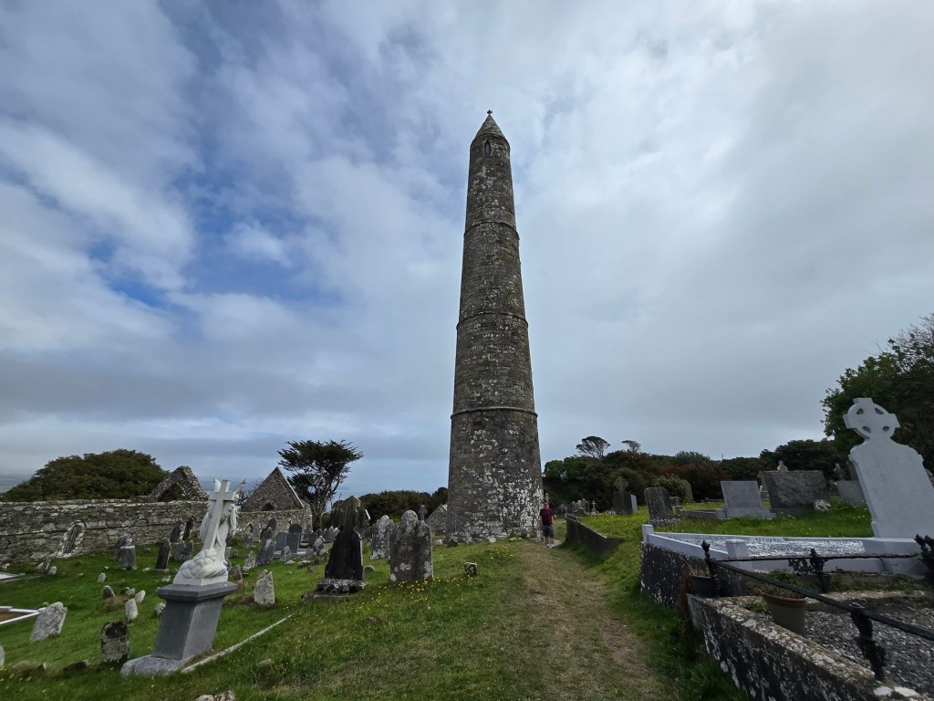
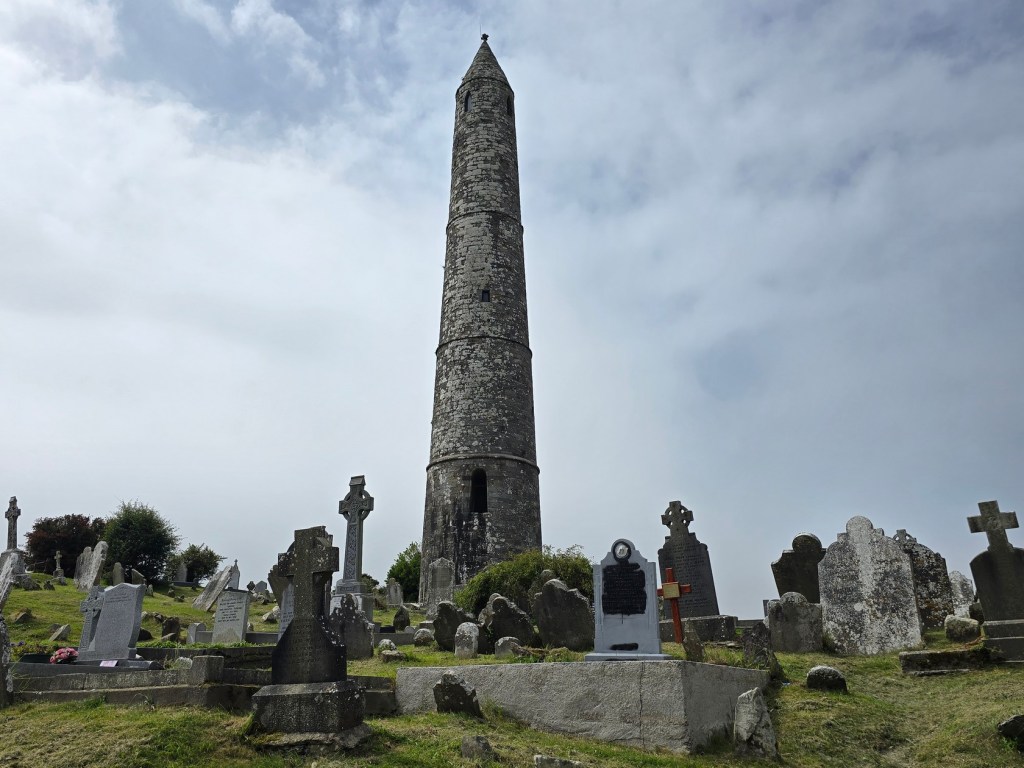
The round tower is located atop a hill in the town of Ardmore in the middle of a cemetery. It’s easy to reach by car and you can park on the road directly outside the cemetery walls.
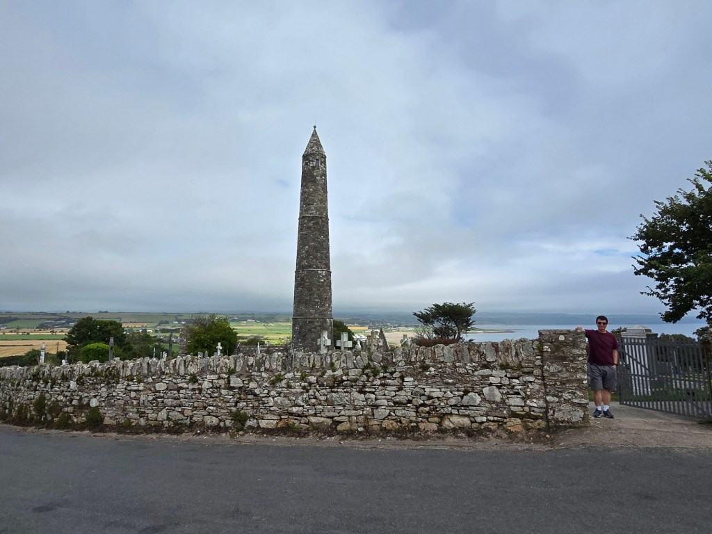
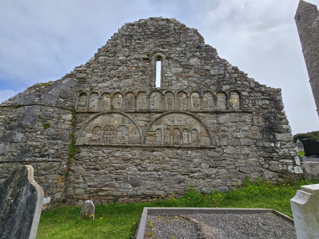
The Round Tower was likely constructed during a power struggle between Ardmore and nearby Lismore during the 12th century. Standing approximately 30 metres (98 feet) tall and measuring about 5 metres (16 feet) in diameter at its base, the Ardmore Round Tower is a striking example of medieval architecture. Its unique design features three distinct external ring courses that taper toward the top, giving it a needle-like appearance. It was designed to withstand the elements and protect its inhabitants during times of conflict.
There have been excavations around the base of the tower revealing insights into its history. Archaeologists discovered human skeletons that predate the tower itself, suggesting that this site had been significant for centuries before its construction.

One of the most intriguing aspects of the tower is its elevated doorway, positioned about 4 metres (13 feet) above ground level. It required a long ladder for access, allowing the monks to retreat to safety during raids.
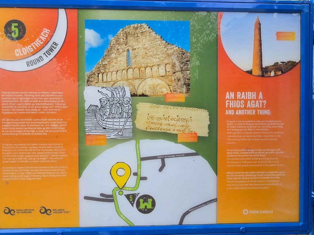
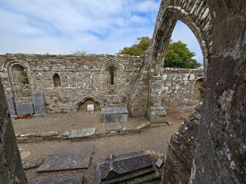
Ardmore Tower is believed to be associated with St. Declan, a monk who founded one of Ireland’s earliest monasteries in the 5th century. The nearby Ardmore Cathedral and St. Declan’s Oratory are also located in the area.

Capel Way Coastal Trail
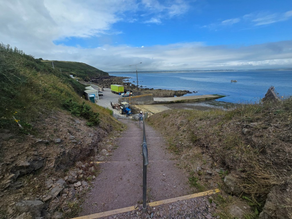
After spending some time at Ardmore, we continued on to the town of Knockadoon, where we planned to check out the Cape Way coastal trail. We drove through the town and found lots of space at the parking lot located at the top of a hill overlooking the coast.
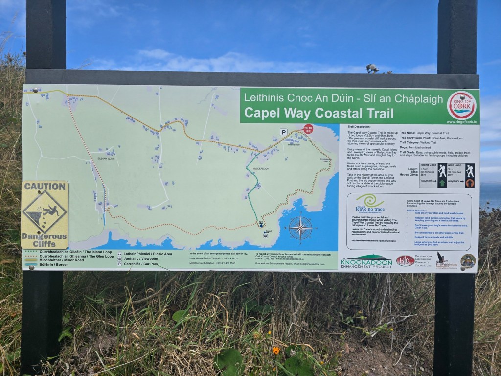
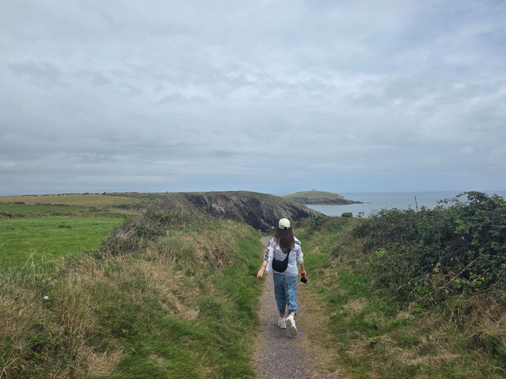
The picturesque fishing village of Knockadoon is situated on the northeast side of the Knockadoon Peninsula, and the trail entrance is close to a Dominican Order camp that has been around since the early 1920’s.

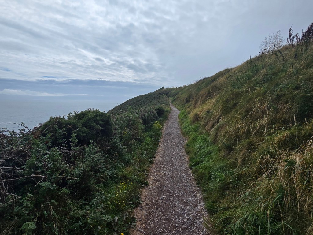
The trail is well maintained, and not too busy when we passed through it. The views off the south coast were impressive, and the weather was nice with a mix of sun and clouds and mild temperatures.


The Capel Way Coastal trail is named after the 12th-century de Capelle family, who were powerful landowners in the area. This includes nearby Capel Island, site of a lighthouse and nature preserve.

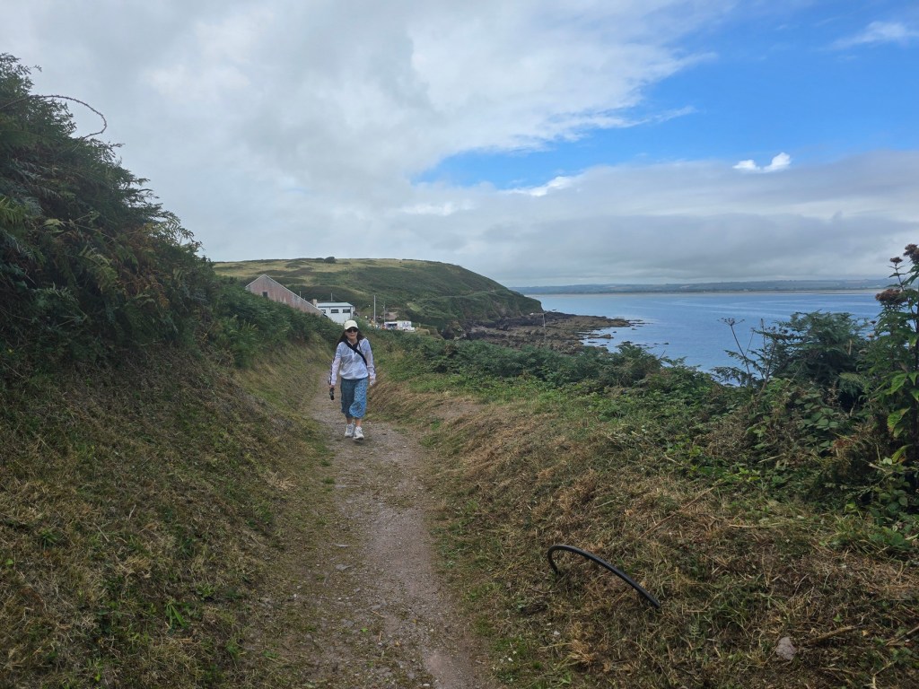
We continued along the gravel trail, occasionally saying hello to passers-by. We highly recommend both this trail and the Capel Way trail if you like picturesque walks along the ocean.

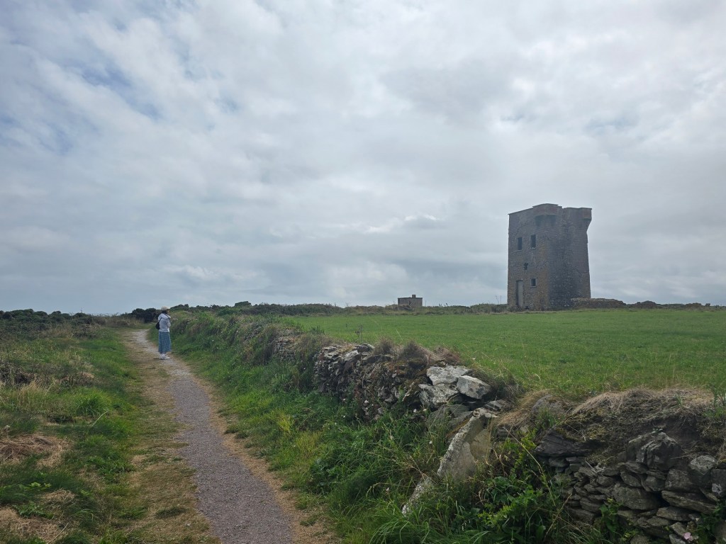
Near the end of our walk were a couple of interesting historical sights. One was a Napoleonic-era signal tower built around 1805. It was constructed in response to threats of an invasion from France. The other was a WWII lookout post that was manned by the coast watching service back in the day.

The coastal trail is a loop trail, but we returned the same way we came as the rest of the loop goes inland. We don’t get to enjoy coastal views often, so we couldn’t miss one more chance to have the experience!
Ballycotton Cliff Walk
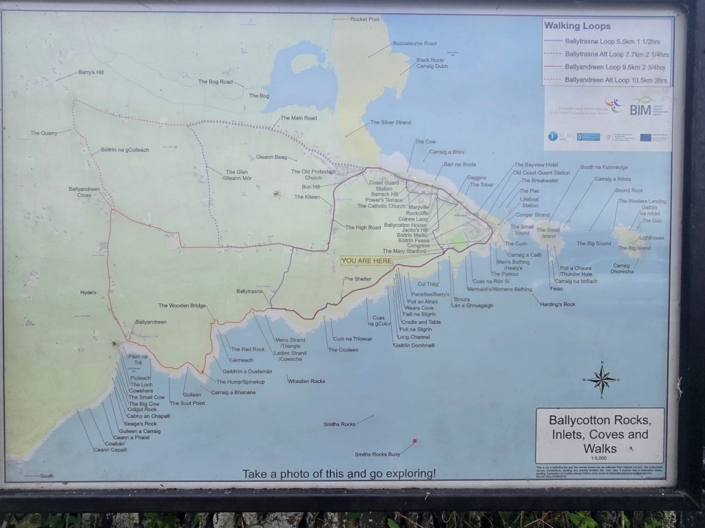
We had enough time to do one more coastal trail, so drove a little further and made our way towards the town of Ballycotton. The Ballycotton Cliff Walk is 7km (4.3 miles) in length going there and back, and should take around two hours or so depending on your pace.

The town is deeply connected to the area’s maritime past, particularly the nearby lighthouse and lifeboat station. The lighthouse was built after the shipwreck of the Sirius in the mid-1800s.
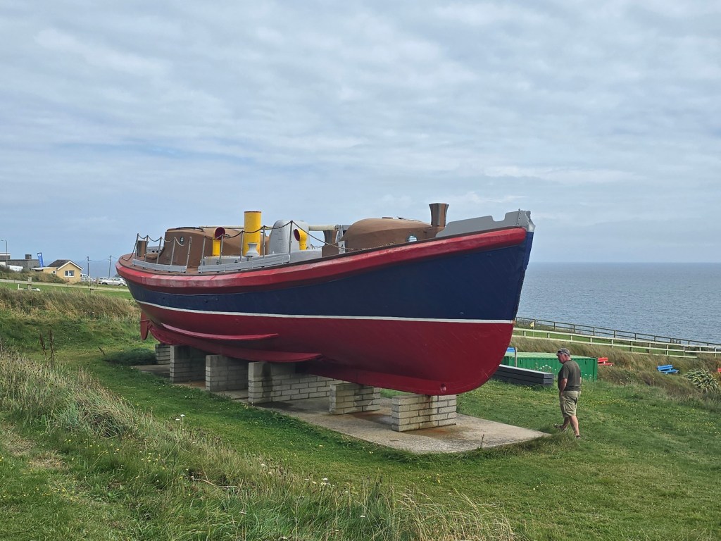
As we began the Ballycotton walk, we passed the restored Mary Stanford lifeboat along with some commemorative displays and information about the walk itself. The Mary Stanford lifeboat was known for the dramatic rescue of the crew of another ship that sank in bad weather in 1936.


As in the case of Capel Way, the gravel course was well maintained and easy to follow. We had less time for this walk but still managed to go quite a distance.
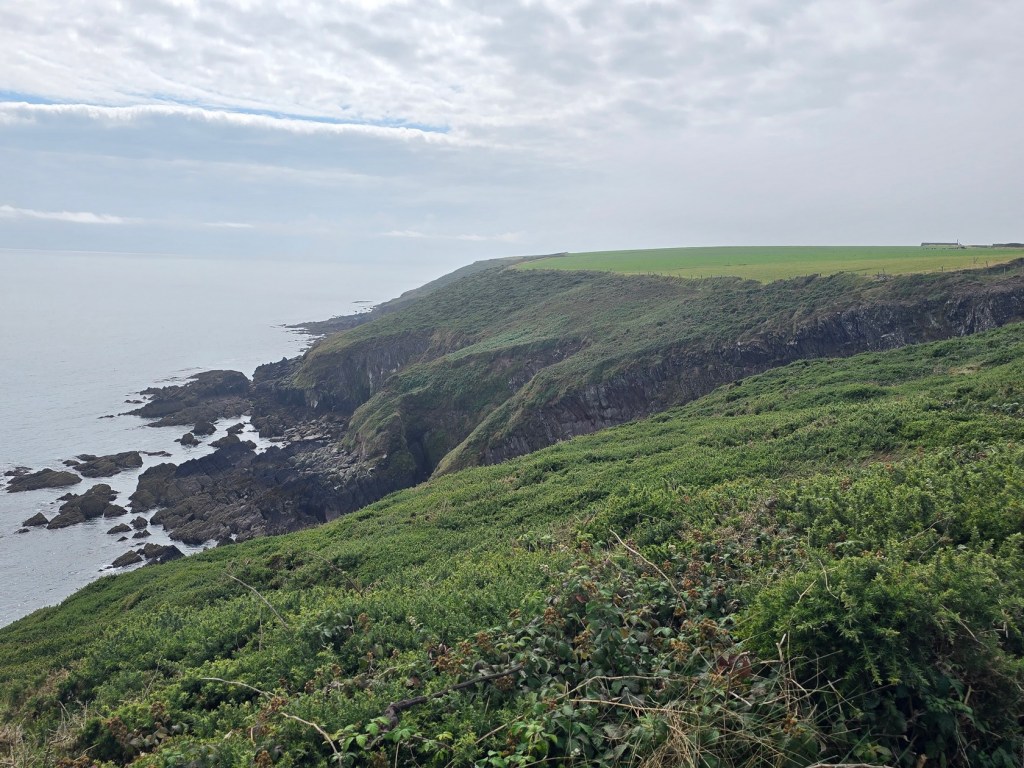
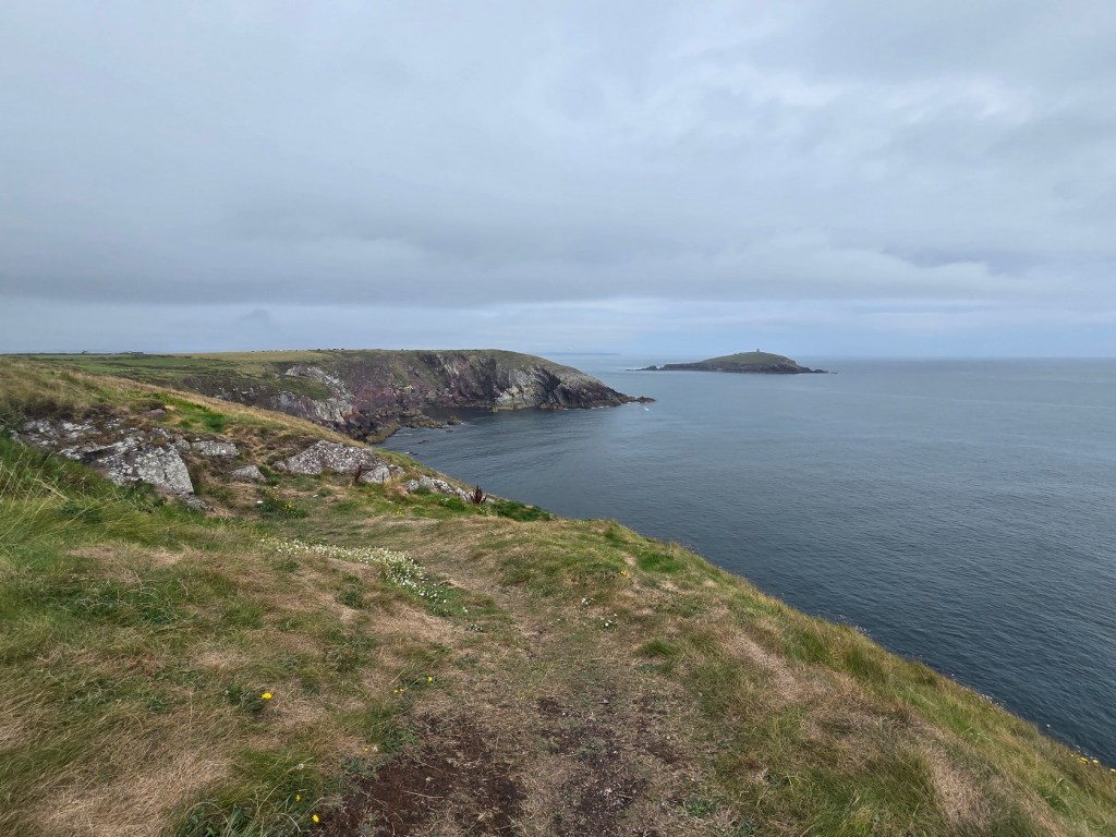
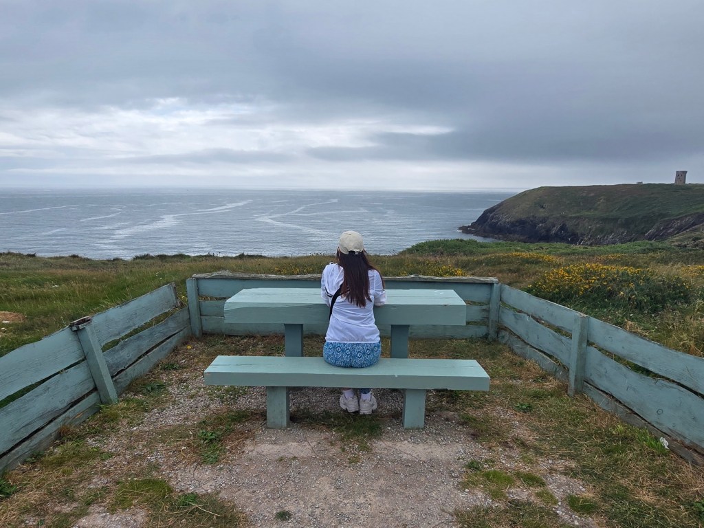
The Ballycotton Trail offers stunning views of the southern coastline, including Ballycotton Bay, Youghal Bay, and Capel Island. A fence runs across much of the trail, separating farmland and private residences from the publicly-accessible trail.
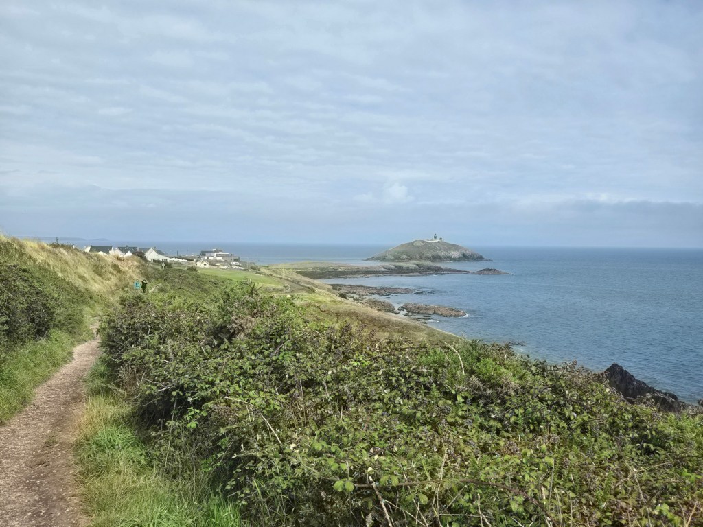
The walk offers views of the Ballycotton Lighthouse, built in the 1840s. It was painted black in 1902 to distinguish it from the lighthouse we passed on the Capel Way trail.

Eventually we turned around and went back. It was now late afternoon and we had to reach our Air BnB outside of Kinsale, so we drove further west. After arriving and resting for the night, our next plan was to check out some interesting sites in County Cork. They will be the subject of the next post!
